Planning
Situational awareness
When an ANAFI drone is deployed in an intervention zone, situational information crucial to the conduct of the rescue operation can be immediately obtained. The entire field of action can be observed from the sky, from all angles. This unique vision makes it possible to calibrate the operation, identify areas at risk, estimate the extent of damage and even locate victims or people in danger. ANAFI is a key asset in the event of a natural disaster, when the known operating environment has been disrupted, and every second counts.
Adapting the intervention system
Thanks to the information collected by ANAFI, the rescue teams can plan their operations and adapt their system to the situation. Faced with a climate disaster, there are numerous and multiple equipment requirements. By using ANAFI, the most accurate calibration of these means to be deployed across the zone can be obtained. By locating and identifying victims and the injured, the resources required for on the spot assistance can be deployed. In addition, ANAFI-compatible software provides rapid modelling of the terrain affected by the disaster, giving a better understanding of the intervention zone.
Carry out your mission diligently
First responders in an emergency situation are always against the clock. Thanks to real-time access to the images collected by ANAFI, all the teams involved can access crucial, visual elements in real time. By identifying points of interest, teams can be sent directly to these areas, avoiding a crucial loss of time.
During search missions, ANAFI can fly over and observe a large area, to plan ahead for the effective deployment of ground teams.
Free yourself from visual clutter
It is always useful to have a view from above during a rescue mission. In an urban or congested environment, first responders face visual pollution that often disadvantages the conduct of the mission, right from the planning phase. ANAFI provides all the teams involved with real-time aerial coverage of the accident zones, which allows rapid identification of grey areas and points of interest.
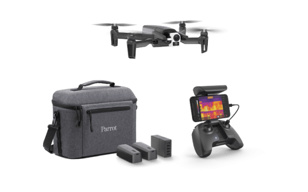
The thermographic sensor is particularly useful for seeing through smoke and detecting the presence of people.
Increasing the number of aerial sensors
Over an extended intervention zone and depending on the needs of the rescue teams, several ANAFI drones can be deployed. This opportunity arises from the inexpensive price of ANAFI, which allows rescuers to acquire several drones for a lower cost than that of a single helicopter trip.
Enough to cover several large areas and obtain visual information crucial for the continuous surveillance of space and points of interest. Decision makers and stakeholders have a complete overview of the incident.
Securing
Securing the intervention
Aerial observation of the intervention scene allows the emergency services to identify risk zones or the dangers inherent in the zone. Carrying out an identification phase a few minutes before the launch of the rescue mission means therefore that the safety of all the operators present is strengthened.
Identifying victims
By using ANAFI as a means of intelligence and observation, priority operations zones can be identified and alongside this the stages of the operation can be prioritised. When people are evacuated, the optical sensors can also support the emergency services in identifying safe areas to transport them to.
During population movements and migrations, ANAFI is able to identify high-risk movements and situations, which may require a rescue team to be dispatched.
Protecting response teams
By identifying the risk zones of the intervention, the rescue operation can be calibrated so that the safety of the responders is strengthened.
Access zones can therefore be identified, allowing them to reach the disaster-stricken area and the injured more quickly and more safely. The visual support provided by ANAFI has demonstrated real added value in post-natural disaster operations.
Locating suspects
Optical sensors and aerial photography is used to identify the presence of suspects, and locate and follow them.
The thermal sensor can be particularly useful in this regard, especially when the visual field is congested and it disadvantages detection in the visible.
It also provides crucial information to the intervention teams, therefore enabling them to apprehend the suspects without putting themselves in danger.
Identifying entry points
The manoeuvrability of ANAFI and the options for tilting its camera enable it to locate entry points to a building or infrastructure. This benefit is clear both for rescue missions, in order to gain rapid access to the wounded and avoid congested access points, but also for police forces since they can gain an understanding of a situation more quickly and discreetly.
Securing data
ANAFI can carry out missions without an external data connection and the user can manage its data storage himself. There is no risk of sensitive information leaking to foreign servers.
This is of particular benefit to police missions, which often take place in sensitive or critical areas.
Control
Unrivalled value for money
With its low price, ANAFI is a particularly profitable investment for rescue operations. It can be considered as a consumable, whose loss is easily amortised.
Compared to other aerial means, such as helicopters, ANAFI's value for money is unbeatable: one single purchase enables repeated deployments of the drone, while each helicopter intervention is extremely expensive.
Go faster
By identifying areas of interest by air, ANAFI allows rescuers to respond very quickly in the area.
ANAFI also offers significant time savings in terms of training. A few hours are all operators need to master the drone and its flight app.
Reducing the logistical footprint
Carried inside a satchel or backpack, ANAFI is a compact and very small drone.
Its logistical footprint is therefore very low and it can be set up very quickly, without the need for any specific infrastructure.
ANAFI, an accessible tool for everyone
ANAFI acts as a remote eye for rescue teams.
Adopting and deploying it, removes the need for a major human resources input. Everyone continues to carry out their usual assignment, but the operation is enriched by the in-flight data collected by ANAFI.
Securing the data collected
With the series of ANAFI-compatible software, the data collected is easily processed and allows for optimal exploitation of the mission.
Using Pix4D Capture or Pix4D React software, for example, ANAFI allows you to model an operations area and take precise measurements. Such data enriches mission reports and can improve the preparation of subsequent operations.