earth

Improve your navigation

During a recovery or search & rescue mission, ANAFI USA is a powerful tool to help respond quickly, operate efficiently, and gather critical and advanced situational knowledge to inform responder strategy and operations. Among the most important features of ANAFI USA, is one that is mercifully missing - geofencing.


In the public safety world, coordinating permissions, launch certifications and manufacturer access to launch in restricted areas all represents critical time lost. As an IP53 qualified drone, ANAFI USA is suitable to fly in rainy and windy conditions. From the case to the sky in less than 55 seconds, ANAFI USA allows search & rescue teams the flexibility to launch responsibly and quickly when and where there is a need.
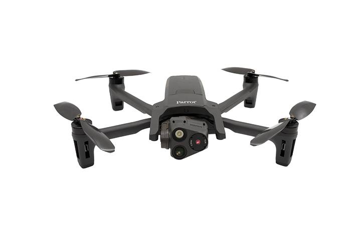
Serving as a powerful eye in the sky for operation leaders and those in the field, ANAFI USA’s 32x zoom allows operators to see the entire visual scene clearly from up to 5 km (3.1 miles) away. The thermal images from the FLIR camera, blended with the zoom image, in addition to the exact GPS coordinates of the drone and point of interest, help responders locate a person with precise detail to guide rescuers directly to the target.


ANAFI USA is compatible with the industry leading mapping software Pix4Dreact to allow first responders in devastated areas without internet to quickly create offline precise 2D maps.


Federal agencies raise concerns about privacy and security of sensitive data collected by drones, and are blocking the use of many, particularly those by Chinese manufacturers. The fact that Parrot is manufacturing in the U.S., trusted by the U.S. Department of Defense, and has been manufacturing and supporting UAS for more than a decade, I have an enormous amount of trust in the company, its products and its reputation.


Justin Adams,

President of The Center for Robot-Assisted Search and Rescue (CRASAR)

Key features

  • Undetectable at up to 130 m
  • Detects moving people from up to 2 km in daylight & up to 150 m at night
  • Post-mission data analysis & scene mapping
  • Compact & quick to deploy in less than 55 seconds
  • Data secured for confidential missions