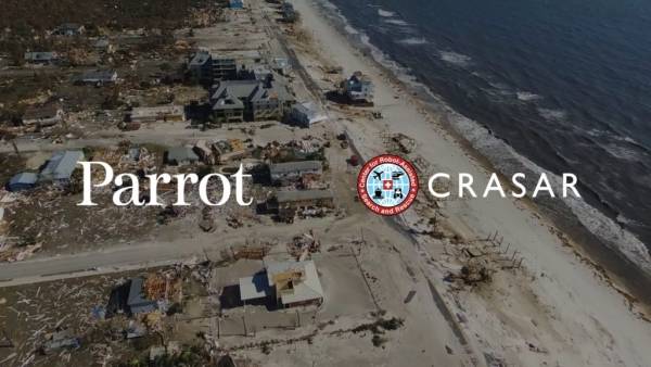
How CRASAR uses Parrot drones in disaster response missions
Use Case
27/02/2020

To the naked eye, these solutions looked like the miniature aircraft frequently piloted by hobbyists: A small remote-control airplane and a small remote-control helicopter. But because both “toys” were equipped with cameras and operated by experts, they provided valuable images that helped disaster-relief teams analyze flood conditions and search for survivors.
These efforts marked the first time unmanned aerial systems UAS were used in a relief mission following a natural disaster. Since then, the commercial and professional drone industries have taken flight, and CRASAR has helped public safety teams explore critical life-saving applications for aerial, terrestrial, and marine robots in real-world disaster scenarios.
For the past two decades, pioneers in the field such as CRASAR Vice President Dr. Robin Murphy, CRASAR President Justin Adams, and CRASAR Executive Secretary David Merrick have provided valuable research, education, guidance, and on-site support for agencies and teams across the globe. Their work is helping future generations of roboticists – and future generations of robots – prepare for the challenges of emergency response.
Parrot had the privilege of interviewing Dr. Murphy, David Merrick, and Justin Adams about the evolution of drone technology, the current applications for drones in the field of public safety, and the features they consider essential in their line of work. Read the Q&A below.
What is the history and mission of the Center for Robot-Assisted Search and Rescue (CRASAR)?
Dr. Robin Murphy: CRASAR started in 2001, right before 9/11. It was started by one of my former graduate students, John Blitch, who was a DARPA program manager looking at designing systems with dual use between the military and emergency response. I am its second director.
CRASAR works with many different types of robots, including ground, aerial, and marine systems. Our mission is to get these robots and these solutions in the hands of responders. In order to do that, we do a lot of data collection and analysis, and we help people in fostering research.
Our mission also means deploying or arranging for responders to use these robots, as well as providing “just in time” instruction materials such as books. We do anything that we can do to help them, and we wind up doing a large amount of deployments. That’s how you learn what the best practices are, and we’ve had researchers embed and perform analysis as part of those deployments.
David Merrick, Justin Adams, and I are researchers, but when we’re in the field, our first and most important role is to support the mission, not to conduct research.
Drones have evolved dramatically since CRASAR was founded. What are the biggest improvements you’ve seen between early UAS and an advanced modern drone such as ANAFI Thermal?
Dr. Robin Murphy: Small unmanned aerial systems, something that a single person or a small team could use, first emerged as a breakthrough solution in the early 2000s. While these technologies existed at the time, they were still fairly primitive.
I think the first big breakthrough we saw was with quadcopters. However, the more recent breakthrough has been the dramatic reduction in cost.
Today, you can get a capable platform under $3,000 and even under S1,000. That $1,000 level is a big break point in purchasing. That’s often where departments decide what they can and can’t afford.
The other significant breakthrough has been in the usability. There’s no police department, no fire department, no emergency manager we’ve encountered that has extra people or extra time for a member of the team to become a full-time drone expert.
David Merrick: As that price point has come down, it’s enabled more and more agencies with limited budgets to adopt these solutions. The ease of operation in those systems has greatly improved, which is another big enabling factor.
Now, you can train someone in a relatively short period of time. And then that training becomes something that they can then use over and over again without having to spend time on retraining.
That combination of lower costs and simpler operation has enabled law enforcement, fire departments, emergency management teams, and many folks who are very busy and don’t have much time to learn new things. They’re now able to start using this equipment immediately.
What are the big advantages ANAFI Thermal brings to your work?
Justin Adams: The first thing is the flexibility of not being geofenced. In the public safety world, there’s an overlap with the real world, and you have to coordinate and get launch certifications in many cases.
A prime recent example, we had a project in Arkansas. There was a fire less than a mile from the airport. I was able to take the ANAFI out, launch it, and do a mapping solution, capture imagery, take video, and do interior assessments. I never had to call anybody at Parrot.
With competing drones, you need to contact the manufacturer, get certification, approvals, enter a serial number… all these steps take a lot longer. And in going through that program, there are data requirements and concerns going on before you can operate.
So the unrestricted component of Parrot’s platform is an important aspect. It’s very important when you’re talking about missions from state to state or region to region.
For example, if David gets called to a tornado in Pensacola, Florida, he has a solution that will not have restrictions due to his role and his work in Florida. Not everybody has that accessibility, but David is a known professional in that area.
In a mutual aid perspective where we go and support other agencies in the state or throughout the nation, other solutions may be only “unlocked” for their jurisdiction, their city, or their county. If they go out to Texas tomorrow to a tornado with a competing drone, they need to communicate with the drone manufacturer to gain access to fly in that area.
So from a responder perspective, the unrestricted use of Parrot’s platform is a significant win. You don’t have to go back and ask the manufacturer to fly in this area or fly in this area. We pull it out of the case and go to work.
Another big factor is the range of things that are on board with the platform. There’s a lot of on-board functionality and processing. Stitching panoramas on board, 360 imagery, having that accessibility and capability to be processed and provided in real-time stakeholders are all very important.
David Merrick: With Parrot, there’s also not a lot of concern about data security. With the ANAFI platform, the data stays with us locally, and that’s a fantastic advantage. The data is not being sent to China or any other location.
Justin Adams: In our field, that’s a big advantage for Parrot right now. It’s not a China-based platform. The Department of Defense, the State Department, and other agencies have flat-out said you cannot use assets that are China-based.
On the federal grant side, you can’t get funding for using drones manufactured by a China-based company. The data usage and privacy are growing concerns, especially on the law enforcement side.
What are the lesser-known benefits of using drones in public safety operations?
Dr. Robin Murphy: It has enabled groups and agencies in rural parts of the country. If you think about what you can do with a manned helicopter, well, many agencies don’t have immediate or affordable access to a helicopter. In Mesa County — Grand Junction, Colorado — they did a study that explained for them to get a helicopter, it represented $3,000 per hour instead of $25 per hour for an unmanned aerial system. The price point of a drone represents big opportunities.
Normally, when you see robots adopted in disaster response, it’s because they provide solutions that couldn’t be done in any other way. Professional UAS usage didn’t start off that way. Instead, they were introduced as providing solutions that agencies otherwise couldn’t afford.
But now, they’re becoming so much more capable than manned systems. With a manned system, you can’t do things as quickly, as cost-effectively, and with the same degree of resolution that you can do with today’s little UASs. You’re seeing them fly indoors and very close to structures, which helicopters can’t do. It’s really exciting to see that shift in how UASs are used in missions.
What are the most common applications for ANAFI Thermal in public safety and emergency response?
David Merrick: The most common application is what we call situational awareness or scene size-up. These scenarios require very little in the way of automation, and almost no post-processing of imagery. It can be done live looking at the screen, or just recording video. There’s not a lot of technical expertise required to do data analysis or anything like that.
That’s what you’re going to see first and foremost out of most public safety folks and first responders. It needs to be easy.
The second most-common application would be mapping applications or 3D modeling, which might be done on an accident scene or for tornado tracking. You’ll typically see that being done by a different group of people with a little more technical expertise.
Law enforcement and firefighters will largely be interested in those simple variations in visibility. They want to see things from a different perspective, or they might want to see a fire scene from a place that they can’t get to safely.
ANAFI is highly successful in both scenarios.

That combination of lower costs and simpler operation has enabled law enforcement, fire departments, emergency management teams, (…) to learn new things. They’re now able to start using this equipment immediately.
Do you always pilot the drone manually? Or do ANAFI Thermal’s presets, automation, and integrated software help you during missions?
David Merrick: It varies on what the requirement is for the incident. I prefer to fly manually whenever possible, but for wide-area searches and things like that, we’re going to depend on Pix4Dcapture and other software to fly that automatically.
Justin Adams: The orbit function is very useful if you’re trying to do a point of interest on a specific location. Being able to do the panoramas from different perspectives is very useful in a damage assessment scenario. And being able to provide those imaging options, as well as 360 views, to your team of stakeholders seamlessly is very beneficial.
So those prebuilt options, as well as the integration with Pix4D, are things that are very useful in many scenarios. And when we are doing autonomous flights, Pix4Dcapture is very beneficial because we will do autonomous flights for mapping missions.
The Flight Plan component in FreeFlight, where we can build a flight plan, having that flexibility is another key benefit. When we have a location that we want to view, especially when we use a point of interest for those, we can drop a pin and say I want to look at X, Y, and Z along this route.
How is the ANAFI Thermal’s FLIR sensor used in public safety missions?
David Merrick: Firefighters love the FLIR, because it reveals issues before they’re visible in any other way. Fire certainly shows up easily with thermal imaging, and if you think about a flat commercial roof, when you’ve got a building on fire, part of the attack might be to want to put people on the roof.
What you can actually see with the FLIR can greatly impact planning and safety. You can see if the roof is hot, if you have hotspots forming, and if you have any potential safety issues that aren’t visible with the naked eye.
Your most effective time to use FLIR for live search targets is going to be dawn. You’re going to have minimal solar heating, because pavement gets very hot in the sun. By flying at dawn, you minimize the existence of that solar heating. It really lets things stand out with the thermal camera.
In nighttime operations and in law enforcement, there are huge advantages with FLIR as well. You can literally see in the dark, and even if you’re not getting great thermal differentiation between your targets and the background, you’re still able to navigate the drone in the dark.
From a responder perspective, the unrestricted use of Parrot’s platform is a significant win.
How do you decide which drones to use when you’re responding to an incident?
David Merrick: We bring a little bit of everything these days. You’re never entirely certain about what you will need, particularly if we’re deploying to a disaster or a hurricane. There’s uncertainty about what the mission requests will be, what the terrain will be, and everything that you’re going to deal with.
So we bring a mix of big aircraft, little aircraft, multi-rotors, fixed wing, FLIR, color sensors, all-weather capable, and all that. Bringing all of those options gives us maximum flexibility and redundancy in case of system failure.
Having more aircraft also gives us the ability, with a larger team of six or seven people, to split into multiple groups. We can start divvying up many tasks between smaller teams.
Justin Adams: Even for a standard application such as mapping, there is no one-size-fits-all solution. You’ve got to look at whether it’s a small amount of area to map or a wider area.
For larger areas, David has used the Parrot DISCO. When you have a large mapping requirement, you really need something that’s more fixed wing. Those give you what we call longer legs.
David Merrick: We use the DISCO for long-range reconnaissance, primarily. Beaches are the classic case there. We can see a long way in both directions, and the DISCO has a 45-minute flight time. You can capture a long distance up and back, and it’s great for capturing initial assessment of the shoreline very quickly. We’ve used it in pretty much all of the storms, including Hurricane Michael.
In normal wind conditions, the fixed-wings offer big benefits in battery efficiency compared to a multirotor. Lift is provided aerodynamically, and you usually have a single motor to provide thrust. That translates to better battery life, because the rotors are not the only thing holding the aircraft up.
But there are also disadvantages for a fixed-wing drone. One is the complexity of operation. They require more training and more proficiency to fly well.
The second one is they need space to launch and recover. Unless you have some sort of vertical recovery capability — parachute, deep stall, something like that — you’re going to need a soccer field to operate that from.
The third is the inability to hover. If you see something, you’re going to have to circle back around and come at it again. It takes a little bit of getting used to.
So for a wide-area search or a big map, fixed-wing is fine. It’s going to collect a lot of data quickly, and I’m going to review it on the ground or process it on the ground after the fact. I don’t necessarily need to be able to stop and look. But I only use a fixed-wings if I’ve got a crew capable of operating it and a space big enough to fly it from.