Regular and precise building inspections are essential in detecting common deterioration or critical building damage such as defective concrete, spalling or loose plaster, water seepage from pipes or cement walls, and structural cracks inside external walls.
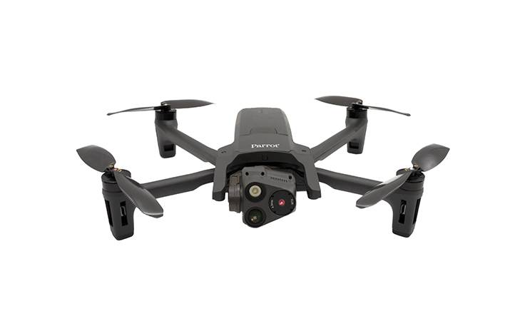
With its 4K camera and 90° upward tilt, ANAFI USA is the ideal tool for building inspectors, structural engineers, surveyors or construction technicians when it comes to effectively inspecting buildings in detail, especially for inaccessible areas such as the underside of bridges.
The assessment of structutal condition and site awareness with ANAFI USA can be optimized and enriched with images taken with its exceptional quality FLIR Boson thermal camera, that will help understand the conditions and make key decisions in regard to the the extent and the reasons of the building damages or deterioration – otherwise not noticeably to the naked eye. This could be heat leaks that are not well isolated, or water infiltrations that cool down the building. Images taken with ANAFI USA will also help assess the scope of work, budget, and work schedule, to eventually optimize the maintenance or the construction planning and the quantities for materials required.
Using ANAFI USA enables efficiencies and safety, mimizing exposing the drone operators to the numerous hazards found on a construction site everyday such as climbing a scaffolding - ANAFI USA’s 32x zoom enables staying at a safe distance from the building, without missing any precious data.
ANAFI USA’s compact and foldable design, combined with an incomparable maneuverability and flight endurance of 32 minutes, will ensure the good conduct of all missions, even in rainy or dusty situations, thanks to its IP53 qualification.
The post-treatment phase is also crucial in identifying and precisely locating any structural or construction anomality, being able to create detailed analysis and accurately quote for materials and labor thanks to ANAFI USA’s compatibility with leading mapping software Pix4Dmapper. The latter allows 3D reconstructions of sites, buildings and structures to review, analyze, even gain detailed measurements, post flight and offsite.
