The largest Software Ecosystem for drones

We keep on expanding our global ecosystem of drone software and hardware providers through our SDK Partner Program.


Contact us to become a software provider for Parrot drones.

Parrot fits business needs

We offer specialized and unique solutions for the growing and evolving needs of professional users.

Leverage our compatible drone software ecosystem, from fleet management, flight plan and flight logs import, to surveying, mapping, monitoring, and data analysis.

Automated inspection

PIX4D – a complete Software Suite for mapping and 3D modeling

PIX4D provides automated industrial inspection. The software use photogrammetry algorithms to generate digital twins of mapped surfaces and infrastructures. Computer vision algorithms are used to automatically give the status of the antenna of a telecom tower mapped.

Drone Harmony – a flight planner for complex mission

Drone Harmony’s Application allows inspection professionals to eliminate errors by optimizing the drone position to capture the most accurate data. The flight planner considers the ground level for large scale topography mission. Drone Harmony also allows flight planning for building facades mapping and inspection of industrial infrastructure. Coupled with the ANAFI Ai's 4G connectivity, the solution is particularly acute for mapping in interferences-ridden urban area where Wi-Fi might be very challenging.

Hoverseen – drone-in-a-box for automated monitoring

Hoverseen provides Parrot ANAFI drones as an automated surveillance solution that can be deployed and charged from a lightweight docking and charging station.

It does not require specialized pilots to operate.

Hextronics - Leader in Drone-in-a-Box System Design and Deployment

Hextronics is an engineering group that provides products for drone autonomy. With roots in Atlanta and Miami, Hextronics' products are designed and built in the USA. With systems deployed in 20+ countries in a variety of industry sectors, Hextronics' Customers are shaping the world of Aerial Autonomy. The Hextronics Universal Nest is designed to house and recharge the industry's most powerful drones for commercial, government, and enterprise operators including the ANAFI USA and ANAFI Ai.

UgCS - professional mission planning software

Parrot ANAFI drones are compatible with Universal Ground Control Software, published by SPH Engineering. It is a standard data acquisition tool for professional drone pilots working with a fleet of multi-vendor drones, as part of large-scale surveying projects. UgCS also offers key features, such as custom altitude data import, terrain tracking mode, and geo-referenced video streaming.

UAVIA – automated surveillance missions planner

UAVIA Robotics Platform empowers industrial sites with real-time aerial inspections and surveillance from anywhere on the globe, anytime. This web-based solution allows remote mission scheduling, collaborative operations, data analysis and archiving.

Drone fleet management

DroneSense - Drone Software Platform for public safety

Parrot ANAFI drones are compatible with Dronesense solution. This solution is widely used in the US by Fire and Police Departments. It is composed of 3 components: Airbase (flight and pilot management), Pilot (mission planning and piloting app) and Ops Center (real time cloud sharing platform).

Aloft - platform for flight and drone workflows

Aloft (formerly Kittyhawk) is a single system of record for enterprise drone operations. The platform unifies the mission, aircraft, and data to make drone operations safe and reliable.

Measure - flight management and planning solution

With measure Ground Control flight management and planning solution Parrot ANAFI drones users can fly, track and manage their drone fleets in real time and ensure perfect compatibility with Pix4D's solutions. It is deployed by many companies to ensure the harmonization, efficiency and traceability of manual or automated missions.

High Lander – drones for first aid and rescue teams

High Lander provides drone fleets with autonomous flight, intelligent airspace control and coordinated air continuity through its Mission Control platform. The platform addresses the needs of first aid and assistance and rescue teams but also for surveillance and mapping missions by providing real-time reports and telemetry, manual or automated route planning and many settings features specific to ANAFI drones.

VOTIX - Drone Automation, BVLOS Operation, Precision Landing and Drone-in-a-Box Integration

VOTIX is an American drone software company that developed the first platform capable of truly delivering drone automation, orchestration and remote operation. VOTIX is fully integrated with Parrot drones and connects directly to the drone without the need for the ground controller. VOTIX automates Parrot's missions, providing BVLOS operations, precision landing and drone-in-a-box integration. VOTIX is a cloud platform that automates drone operations so you can MANAGE missions, resources and data, STREAM real-time flight videos to anyone, and FLY drones remotely and autonomously from anywhere.

Augmented Reality (AR) for drones

RIIS - Artificial Intelligence applications for drones

RIIS focus on the use of AI and computer vision technology, combined with drone data capture.

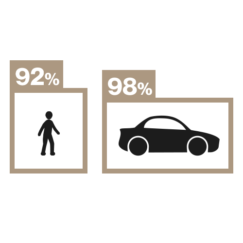
They provide solution for professionals such as assessing the number of parking spaces, public lighting, reporting stocks in warehouses, automatically inspecting mobile phone towers and solar panels, do real estate monitoring for professionals and real estate developers.

Rapid Imaging – AR geospatial solutions and situational awareness

SmartCam3D® SDK program overlays geospatial data such as street vectors, road names, points of interest, polygons, and other relevant map features, on real-time and moving video. This provides professionals on mission with advanced situational awareness during critical drone operations: air law enforcement, insurance, industrial inspections, response to natural disasters, real estate and search and rescue operations.

Textron Systems – services and supports for aerospace and defense

Textron Systems' Optice™ software seamlessly add AR overlays to footage using geospatial context, track objects, share operational data with teammates, record missions, and generate reports. Along with the reading and recording of missions, the software also offers Parrot ANAFI drone pilots forensic exploitation, integrated with data from existing geographic information systems (GIS), to support in-depth site analysis.

Drone data management

Survae – geospacial media player for drone

Survae combines Parrot ANAFI drones aerial imagery with interactive mapping. On a map and timeline, each image is geolocated, dated and time-stamped. The visual search engine allows users to quickly find relevant data and watch videos or images from any point on the map. All videos and images can be easily shared with Survae's interactive video player/card.

DroneLogBook – flight logs synchronization with Parrot App FreeFlight 6

DroneLogBook is a cloud-based drone operations management tool covering all professional drone use in business: mission planning, compliance reports, maintenance reports, and flight tracking. The platform is natively integrated in Parrot App FreeFlight 6 to offer users the automatic synchronization of their flight logs in DroneLogBook.

Cybersecurity for drones

WISeKey – Secure Element for drone

WISeKey provides fully secure microcontrollers to ANAFI drones. The integration of WISeKey digital security technologies, from flight control systems to infrastructure, ensures a secure connection between the controller and the drone. WISeKey's VaultIC4xx security features are certified by the U.S. National Institute of Standards and Technology (NIST) to FIPS140-2 Level 3, one of the strictest and most recognized levels of digital security in the world. These elements are developed on Common Criteria EAL5+ certified hardware, which provides another government-level security certification.

Drone accessories

FoxFury – Lighting for drones

FoxFury builds portable and made in USA LED headlamps for drone. Their application-specific LED lights are used in firefighting, police, military, industrial safety, hazardous area, filming, and photography. They have integrated their LED light system on ANAFI, ANAFI THERMAL & ANAFI USA with small adapters.

Drone swarm

Icarus Swarms – swarm flight system for emergency response forces

Icarus Swarms offers its expertise to easily and cost-effectively operate drone swarms for military, police and emergency response forces.

Icarus Swarms works with the French Army Special Forces, the French RAID, Thales and the Naval Group.