Testimonial

"After 5 years of drone practice, ANAFI has finally given me a device whose technical and photographic specifications meet my expectations. It has a good return on investment and helps my customers!"


Arnaud Fevrier,
professional photographer and videographer, contributor to the magazine Le Minorange (Bouygues BTP) and to BouyguesInside web TV 

Examining

A new way to collect data

Using ANAFI enables aerial shots to be collected and exploited, to enrich the information already in the possession of building specialists. Thanks to the recording of photos and videos, it is now possible to obtain new fixed and mobile shots, at height or at ground level, with both very wide-angle and close-up shots, from new angles.


The specificity of ANAFI's optronic sensor, which can be tilted to 180°, allows drone operators to observe complicated areas of access, which would normally have been impossible to photograph. In addition, stabilised on 3 axes, ANAFI's camera offers a high quality of photos and videos, despite the flight vibrations.


Monitoring changes

Thanks to ANAFI and the various compatible software elements, precise monitoring of works can take place over time and the changes on a site observed at any time.


ANAFI's image quality makes it perfectly suited both to visually immaculate reports and highly technical image capture, allowing for example the 3D reconstruction of buildings or engineering structures.


See the invisible

Thanks to ANAFI Thermal's thermographic sensor, it is now possible for operators to see the invisible and to display elements of information not perceptible to the naked eye on the screen, such as heat leaks on photovoltaic panels. or insulation faults.

In the field of inspection of engineering structures or buildings, the location of anomalies is the number 1 issue. Thanks to ANAFI, it is now possible to detect these elements, either visually, live, from the images retransmitted onto the screen of the control station, or in a later phase, when reviewing the images taken during the flight.


The post-processing phase is then able to identify and precisely locate any anomaly. In this respect, the Survae app is especially useful, particularly for the inspection of large and uniform surfaces.


Immersing yourself

Thanks the to FPV flight, the operator can now immerse himself in the heart of the mission and take a virtual walk around their site. The Cockpitglasses 3 virtual reality glasses allow you to use the control screen in immersive vision.


In photo mode, this wide-angle and live view is able to provide an even more precise inspection. FPV flights can also be used to produce recordings of buildings or civil engineering structures enabling a close-up view and the collection of elements essential for any detailed analysis.


Restoring

In addition to the shots, photos and videos, which provide a first layer of information, what is particularly relevant in the construction industry, is being able to access visuals representative of the work in progress.


All the ANAFI-compatible software brings considerable added value, enables optimal exploitation of all the data collected in flight, and provides an option to produce reconstructions of the observed infrastructure, using 3D modelling.

Freeing yourself

Manoeuvrability

Designed to be mastered very quickly, ANAFI has been created to provide simple and intuitive flying, offering optimal manoeuvrability.


Even on the very first flight, there's no need for days of training and no risk of fatal crash: ANAFI is particularly easy to use, for missions that are always safe, fast and efficient.


Similarly, ANAFI's intuitive interface enables quick and simple management of the drone's functions.


Taking the mission even further

The different flight modes, accessible from the user interface, allow you to go further into the flight and obtain complex plans, even for a novice pilot.

With the Flight Plan option, the pilot programs a route that ANAFI will automatically follow, leaving the operator to focus on framing their shots or the movements of the camera.


Cameraman mode allows you to focus the ANAFI camera on a fixed point of interest, whatever the movements of the drone.


With Touch & Fly, the drone is sent to an exploration area with a simple tap on the map displayed on the screen.


These flight modes offer additional means of obtaining detailed information but without making it any more complex to fly ANAFI.


In addition, ANAFI, its camera and its digital zoom are used to produce compensated tracking shots, to automatically frame a subject, to follow the operator thanks to the Follow Me function and even to make circular flights.


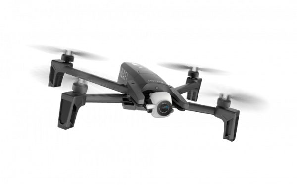
A drone that can go anywhere

Compact and extremely light, ANAFI can be taken anywhere, without weighing down the operator, who is often carrying heavy equipment.


With a weight of 320 gr, ANAFI is transportable in a satchel or backpack, together with its additional batteries, its remote control and its cables.


A cost-controlling tool

ANAFI's price positioning makes it the most competitive drone in its category.


With the services that accompany it, ANAFI represents a much smaller investment than the occasional use of other aerial photography vectors. Furthermore, it is always available.


Finally, ANAFI provides reduced expenditure on other items, such as logistics - by reducing the deployment of heavy equipment or the installation of additional infrastructure as part of an inspection, for example. ANAFI very often removes the need to use scaffolding, which takes a long time to install and is particularly expensive compared to the price of the drone.


Withstanding your environment

Being extremely robust, ANAFI has been designed to be used in the most extreme environments. This gives the drone a strong resistance to wind (50 km/h stable, 80 km/h in gusts).


ANAFI can also be used in extreme temperatures, from hot heats in desert environments to winter cold. It is also very resistant to shocks and furthermore the drone is supplied with spare propellers in case they need to be replaced.


Freedom of movement

ANAFI enables you to find the optimal angles for your photos. The transmission range of the drone opens up an incomparable field of inspection and enables photographers to ascend as high as is required.


In addition, to ensure compliance with regulatory constraints, the operator can create their own virtual barrier (geofencing) to mark out their operational area in height and distance.


ANAFI's battery life, with each battery lasting 25 minutes, is more than enough to shoot long sequence shots or explore and photograph a building from all angles.

Exploiting

Information sharing

ANAFI enables you to instantly share the information collected in flight with all the relevant personnel, in real time or almost real time.


More generally, the images captured by ANAFI are ideal for illustrating your reports, ensuring a visual monitoring of your work.


Capitalising on added value

Before the mission and during the flight, you can optimise your shots by configuring the image options. The photographer can manage the ISO settings, white balance, exposure, shutter speed and even put filters on the lens.


During the post-mission phase, with the different software, it then becomes possible to make the best use of the data collected in flight and therefore use the images to enhance expertise.


By developing a digital model or plan, embellished with real images of the existing structure, project management is improved thanks to very complementary visual, technical and graphic lighting.


Predictive maintenance

From the data collected by ANAFI during its various inspection missions, carry out predictive maintenance models by precisely following the evolution of anomalies.


ANAFI's ease of deployment also enables you to carry out repeated missions, making it possible to identify critical elements requiring particular attention. Focus on prevention, not reaction.


The precise geolocation, the stability of the device, the automatic flight programming via the Flight Plan, Touch & Fly and POI features enable high frequency rounds of shots from identical angles.


Reducing risks

In addition to the data and information collected in flight, ANAFI enables you to reinforce the security of your construction and inspection missions, by not exposing personnel to risk situations.


It is also possible for you to conduct flyovers prior to deploying your teams, in order to locate dangerous areas and provide all operators with all the information necessary for their safety.


The drone is more and more frequently used by technicians and surveyors in their supervision, validation or technical inspection assignments, especially in areas that are difficult to access. ANAFI's precise zoom, combined with incomparable manoeuvrability, enables detailed examinations of inaccessible areas, damage to buildings or infrastructure, without exposing operators to the slightest danger.